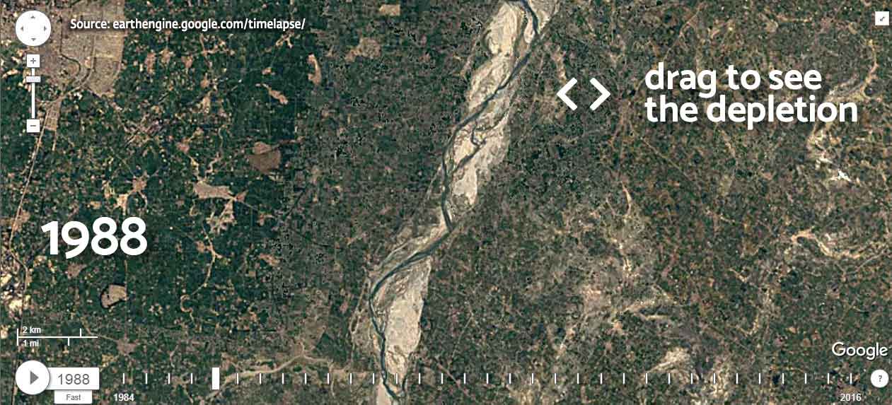
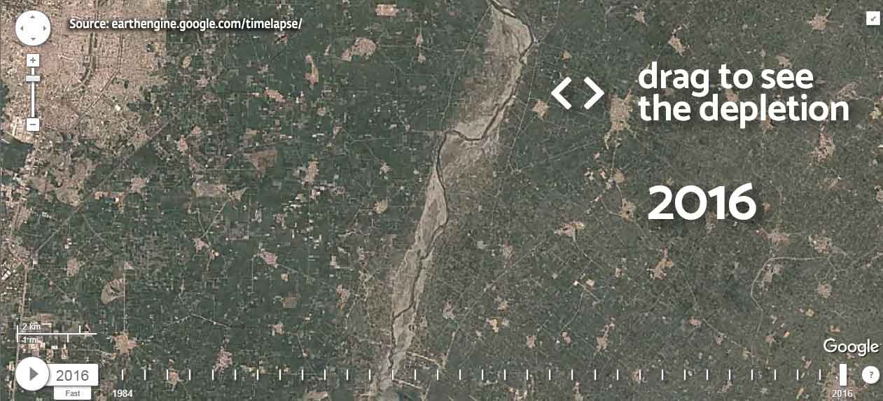
River length: 1376 km
Basin area: 366,223 sq km
Population in basin: 128 million (2001)
States in basin: Uttarakhand, Haryana, Delhi, Uttar Pradesh,


Major cities using water
New Delhi (pop: 19 million), Agra (pop: 1 million), Allahabad (pop: 1 million), Mathura (pop: 349,336)
River Depletion
- Water depletion: 60% (estimation from World Bank report)
- Dry season drought risk: Low-Medium
- Monsoon flood risk: High
- Tree cover loss: 11% (1985-2005)
- Seasonal variability of water levels: Extremely High
Economic & Environmental Significance
- The Yamuna creates the highly fertile Yamuna-Ganga Doab region with the Ganga.
- Almost 27 billion liters are extracted every day from the river. The river accounts for more than 70% of Delhi’s water supplies.
- It irrigates 6 million hectares of agricultural land and provides about 400MW of hydroelectricity
Spiritual & Cultural Significance
The river is intimately connected with Krishna’s life when he was a child.
Indraprastha, the capital of the Pandavas, was situated on the Yamuna’s banks. It is today considered to be the modern city of Delhi.
The Yamuna meets the Ganga at Prayag, one of the most significant spaces for Indians. The Kumbha Mela is held here every twelve years.
The Yamunotri, the origin of the Yamuna, is one of the Chota Chardham pilgrimage spots. The other three are Gangotri, Kedarnath and Badrinath.
References
- http://www.india-wris.nrsc.gov.in/wrpinfo/index.php?title=WRIS_Publications#Basin_Reports
- http://documents.worldbank.org/curated/en/983071491924854124/Major-Ganga-sub-basins-water-balance-analysis-report
- http://www.aloki.hu/pdf/1403_773792.pdf
- https://books.google.co.in/books?id=wNivbEPTAfMC&lpg=PA23&ots=fKeg3ZwU0h&f=false
- Photo Credit: https://www.flickr.com/photos/dms_303/3841989607/